Topografías para Desarrollos Mineros de México
Levantamientos topográficos, Topografía, estacipon Total, Escaneres 3D
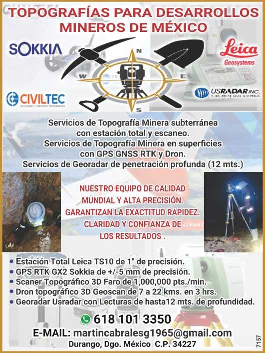
Underground Mining Surveying Services with Total Station and Scanning.
Surface Mining Surveying Services with GPS, GNSS RTK, and Drone.
Deep Penetrating Radar (GPR) Services (12 meters).
OUR WORLD-CLASS, HIGH-PRECISION EQUIPMENT GUARANTEES ACCURACY, SPEED, CLARITY, AND RELIABILITY OF THE RESULTS.
* Leica TS10 Total Station with 1" accuracy.
* Sokkia GX2 RTK GPS with +/-5 mm accuracy.
* Faro 3D Topographic Scanner with 1,000,000 points/min.
* Geoscan 3D Topographic Drone with a range of 7 to 22 km in 3 hours.
* Usradar GPR with readings up to 12 meters deep.
Contact information Visitor No. 301 Since 26/03/2026
- Topografías para Desarrollos Mineros de México
- Durango
-
+52 618 101-3350